Linking Shores
Connecting communities between river and sea
Connecting communities between river and sea
We envision a network of safe, accessible, and seamless east–west connections linking our beachside and riverside communities.
We support strategic infrastructure improvements that enable all community members and all modes of transport to travel with ease and security across our communities.
By addressing the barriers posed by Stirling Highway, the railway, and Curtin Avenue, we are committed to a unified, integrated approach that guarantees children safe routes to school, enhances accessibility for people of all ages and abilities, reduces traffic congestion, and elevates overall liveability.
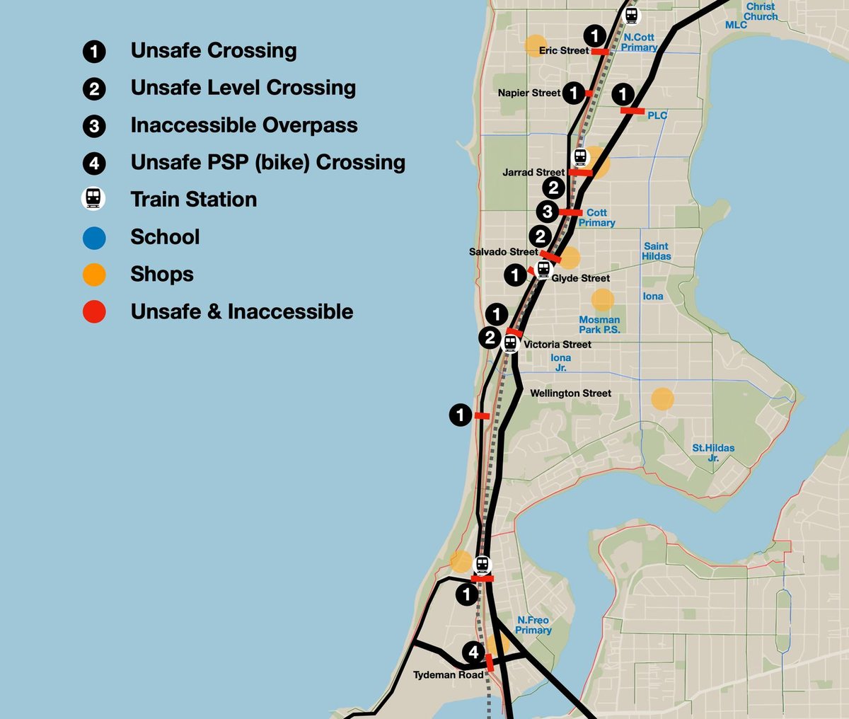
Beach-side and river-side communities are divided by Curtin Ave, the railway, and Stirling Hwy with a lack of safe and accessible connections
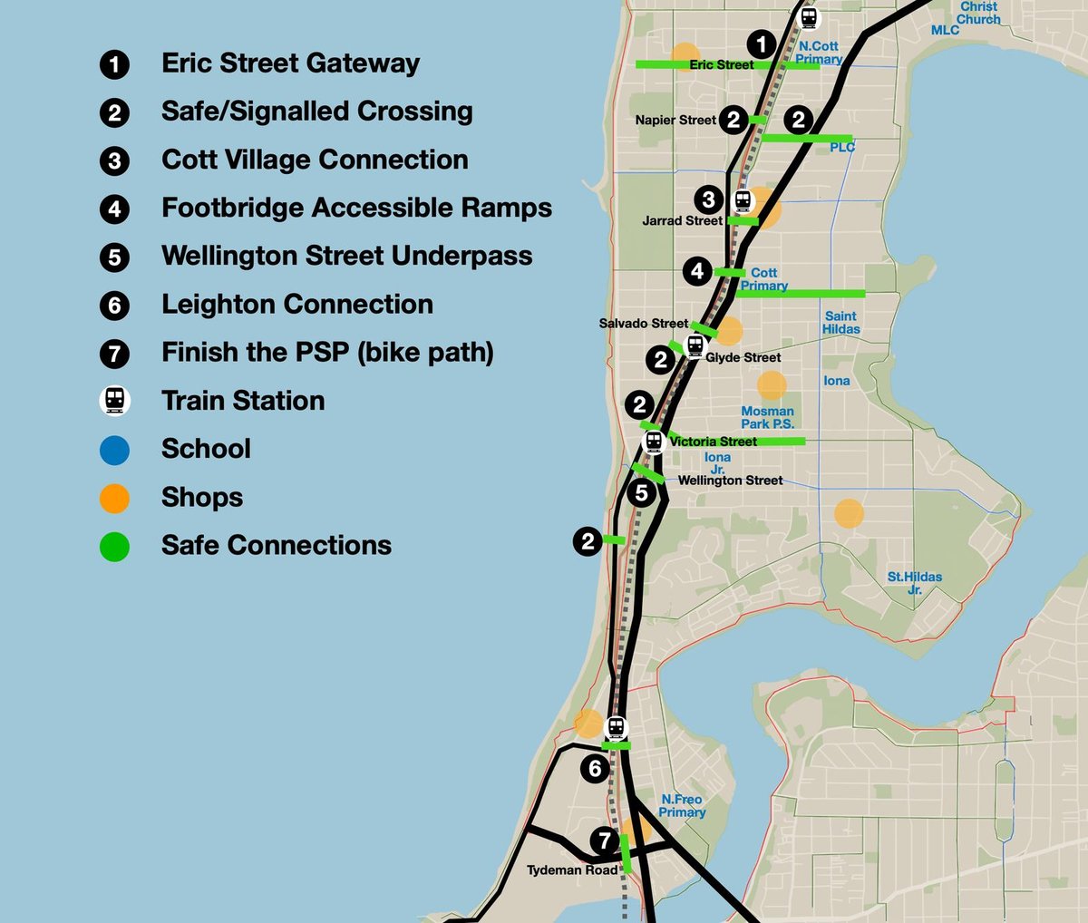
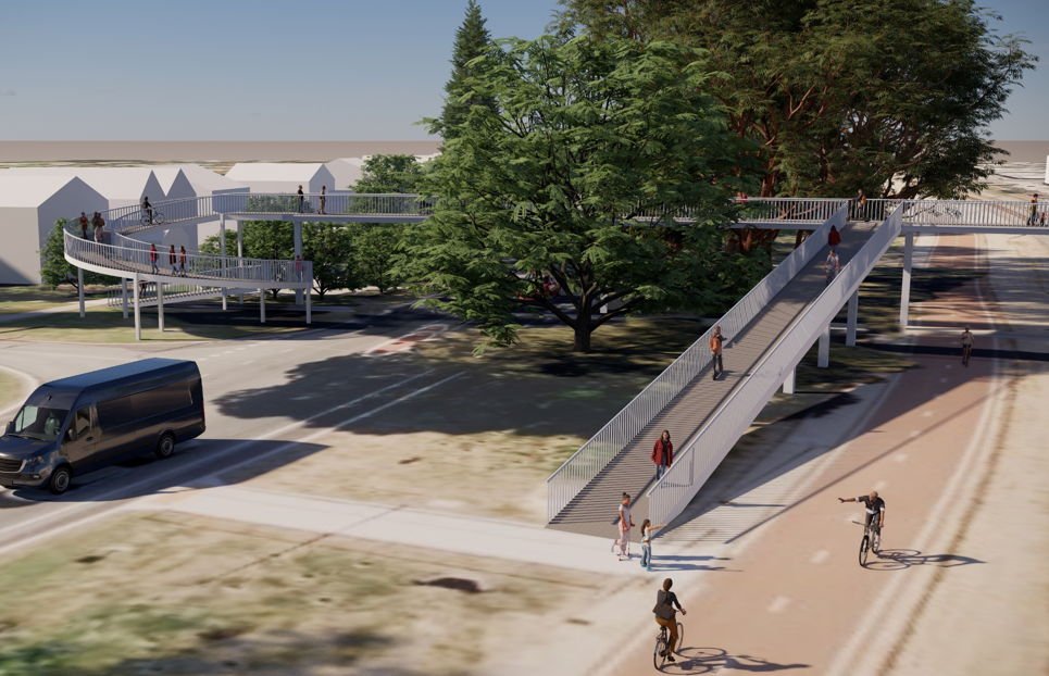
Key projects will deliver safe and accessible connections for all ages and abilities
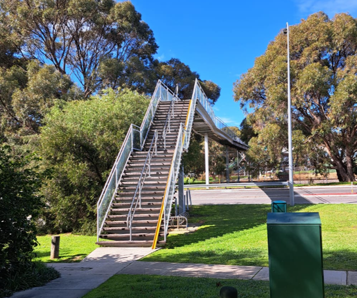
Steep stairs on current footbridge make it inaccessible to many members of community
Lack of connection to PSP Bike Path
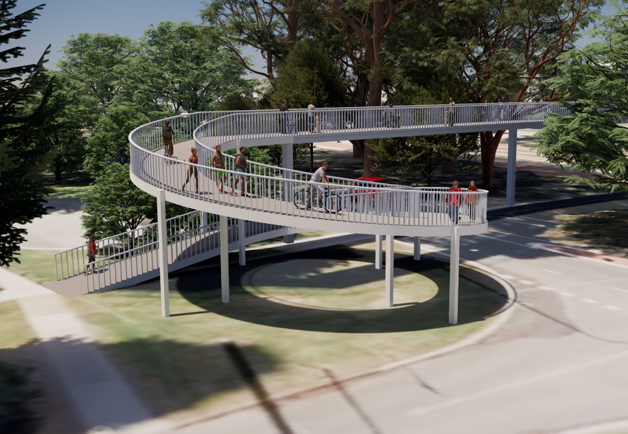
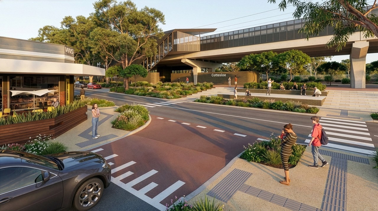
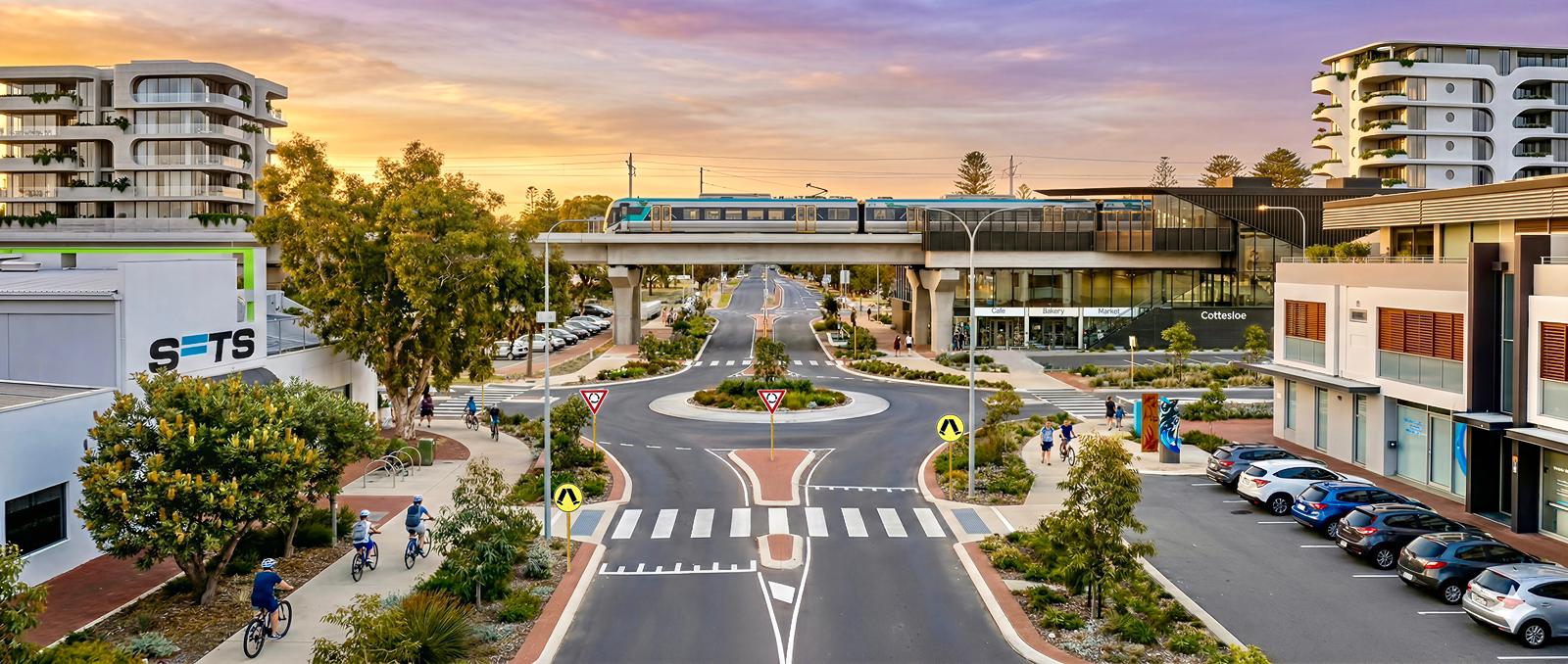
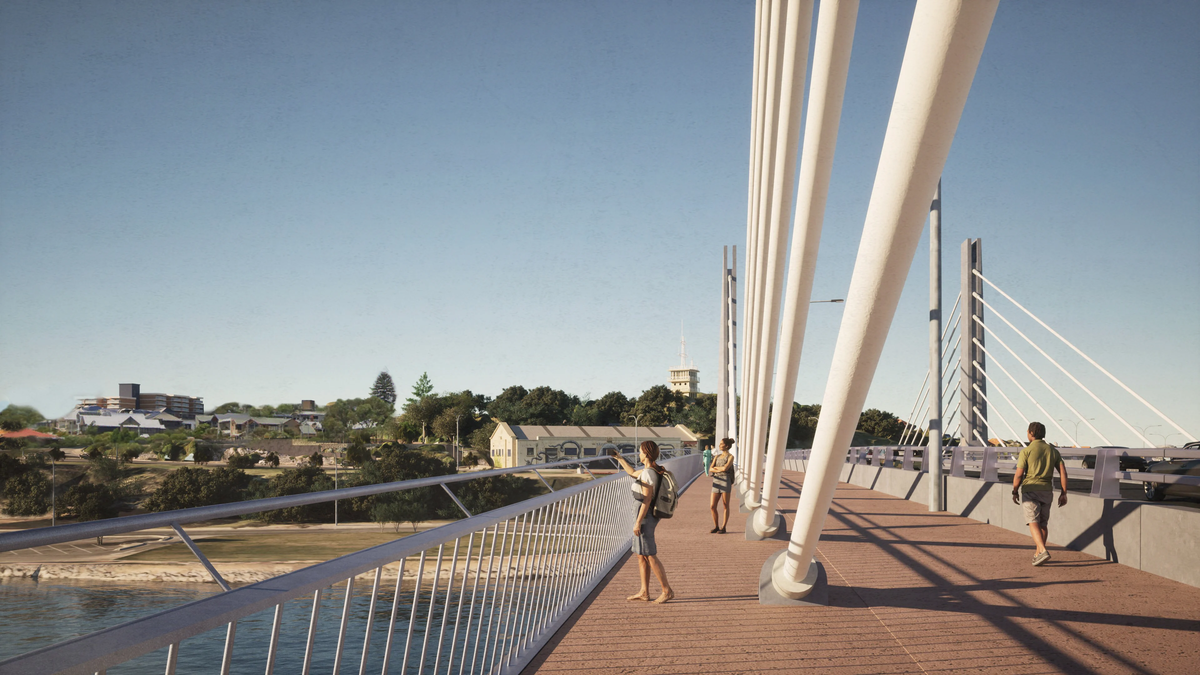
An accessible bridge for beach and river communities
Connection to the PSP Bike Path
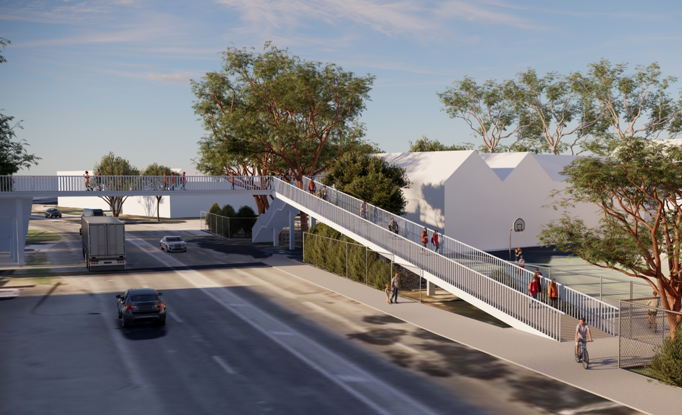
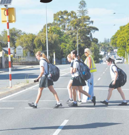
Safe and easy for kids to get to school
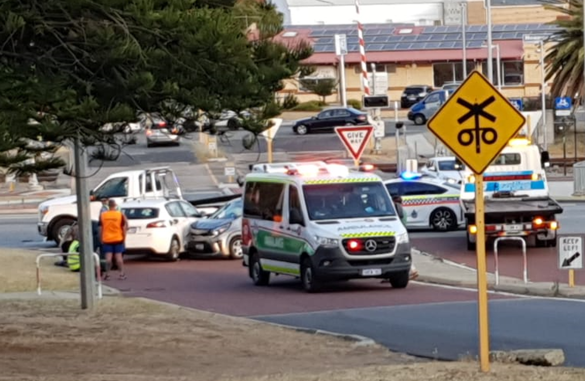
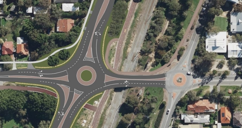
Victoria St and Salvado St level crossings are crash hot spots.
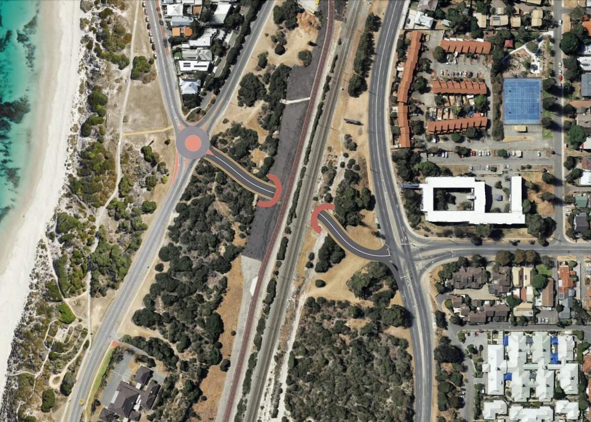
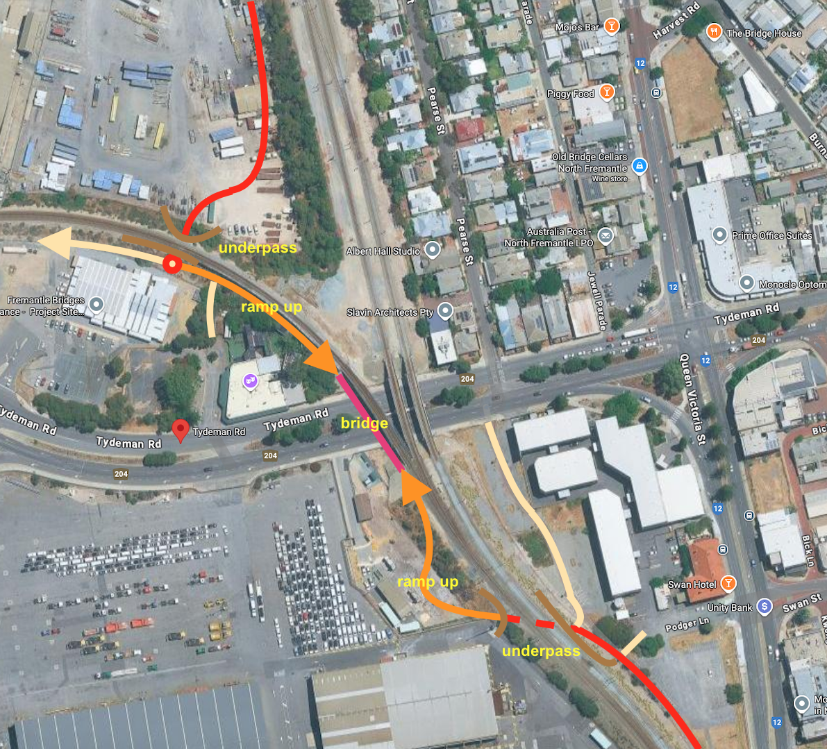
Remove the vehicle level crossings and build Wellington St underpass
Raise section of railway to provide vehicle and pedestrian underpass allowing continuous east-west connection
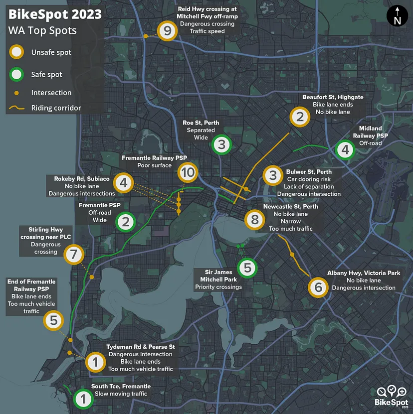
The PSP bike path crossing at Tydeman Rd was voted Perth's #1 unsafe spot in the BikeSpot 2023 survey
Continuous grade-separated crossing is needed to connect Perth to Fremantle across the new Fremantle bridge.
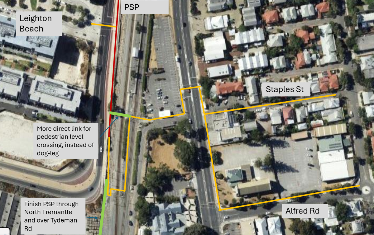
A wider and more direct pedestrian railway crossing would greatly enhance connection between Leighton and North Fremantle
Traffic refuge at Napier St across Curtin Ave.
Safe road design along Victoria St and Johnston St, providing safe routes to primary schools.
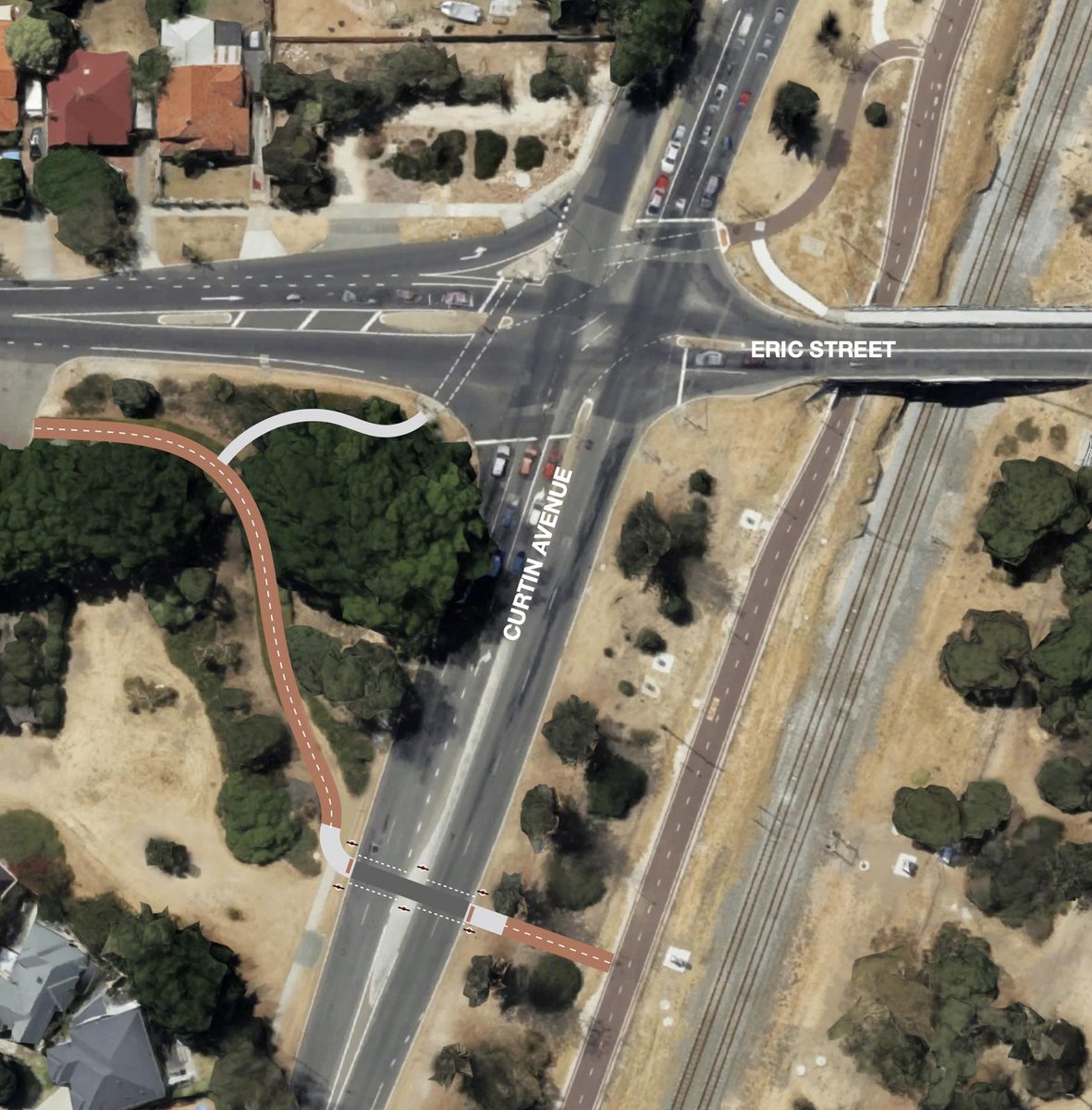
A major bridge upgrade would delivery significant improvements to Eric-Curtin intersection and incorporate a pedestrian underpass to the Eric St Shared Path.
Alternatively a signalled crossing 50m to the south that is synchronised to the lights would allows direct connection between the PSP and the Eric St Shared Path.
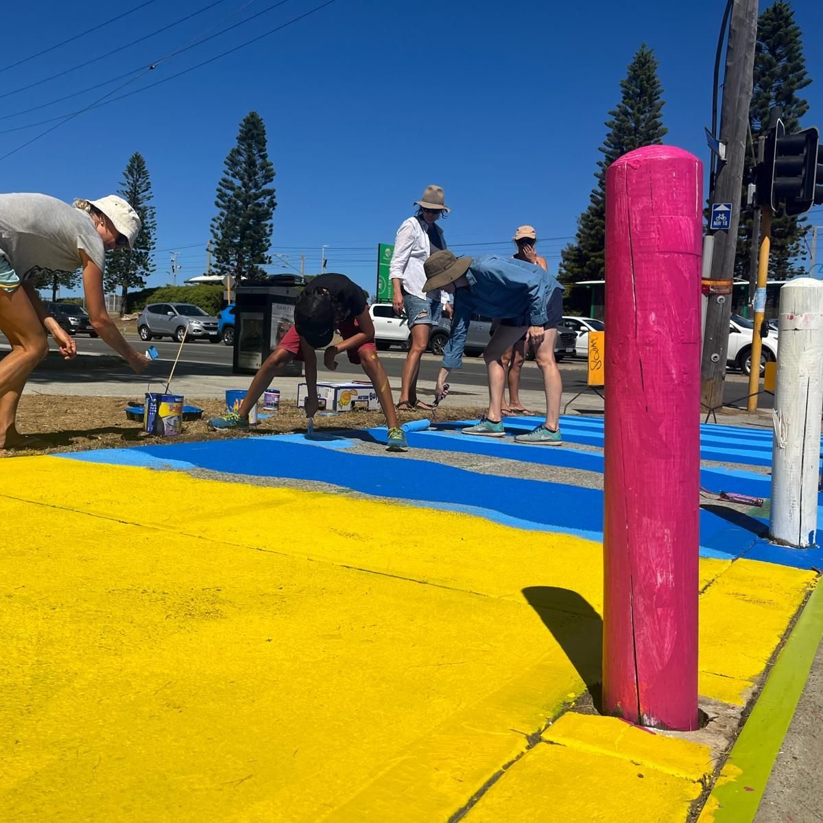
Thanks to all the community members and groups that support our vision.
With your support, this will help us to advocate to Local and State government to ensure these projects are included in planning and budget cycles, and bring our vision to life.

Cottesloe Primary School

PLC Perth

Cottesloe Kindy & Childcare

WestCycle
We'd love to hear from you!
Let us know why fixing this issue is important to you
You can also join the mailing list to keep up to date on progress